SimActive Used for Corridor Mapping Along Coasts
SimActive announces the use of its Correlator3D product by the US Army Corps of Engineers for corridor mapping. The software is used to process imagery and create mapping products in conjunction with topo-bathy lidar systems.
“Correlator3D is by far the easiest to use and fastest image processing software out there.”
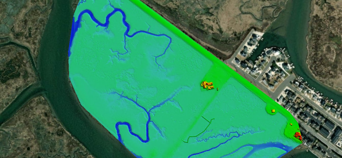
As part of the Corps of Engineers, the Joint Airborne Lidar Bathymetry Technical Center of Expertise (JALBTCX) uses the most advanced sensors to map US coastal shorelines. In combination with topo-bathy lidar, imagery is collected with a Phase One 150MP camera. Surfaces are generated from the lidar data and imported into Correlator 3D along with the imagery to rapidly produce blocks of orthomosaics used for all types of assessments.
“Correlator3D is by far the easiest to use and fastest image processing software out there”, said J. Heath Harwood, Physical Scientist at the US Army Corps of Engineers. “Its DEM editing and mosaic editing tools are outstanding.”
About JALBTCX
The mission of the Joint Airborne Lidar Bathymetry Technical Center of Expertise is to perform operation, research, and development in airborne lidar bathymetry and complementary technologies to support coastal mapping and charting requirements of the US Army Corps of Engineers (USACE), the US Naval Meteorology and Oceanography Command, the National Oceanic and Atmospheric Administration (NOAA), and the US Geologic Survey (USGS). For more information, visit www.sam.usace.army.mil/Missions/Spatial-Data-Branch/JALBTCX.